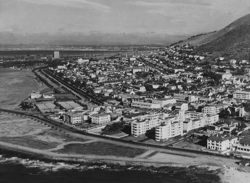
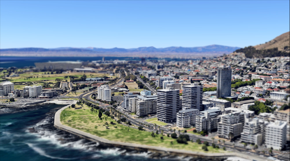
These pictures show how Cape Town looked in the 1940s compared to today

The face of Cape Town has changed significantly over the decades, but the Mother City has always been one of South Africa’s most eye-catching locations.
Established as part of a vital trading route between Europe and the west in the 17th century, Cape Town would become South Africa’s first proper settlement, developed largely by Dutch colonists.
Today, the city is the second most populous city, after Johannesburg, home to over 3 million people – rich in heritage sites and popular tourist destinations, on top of a booming local economy and staggering property market.
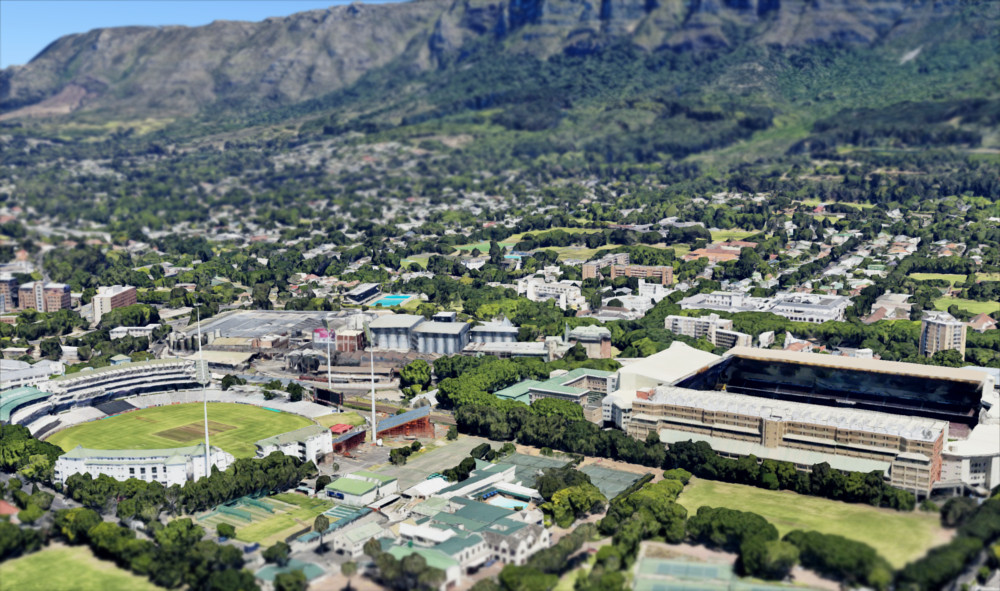
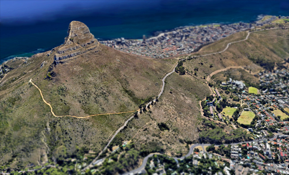
We have previously looked at some of the old photos of Cape Town, offering a glimpse into how the city looked between 1940 and 1980, but now with the wonders of modern technology, we can replicate some of this old photos and how they would look in 2017, almost exactly.
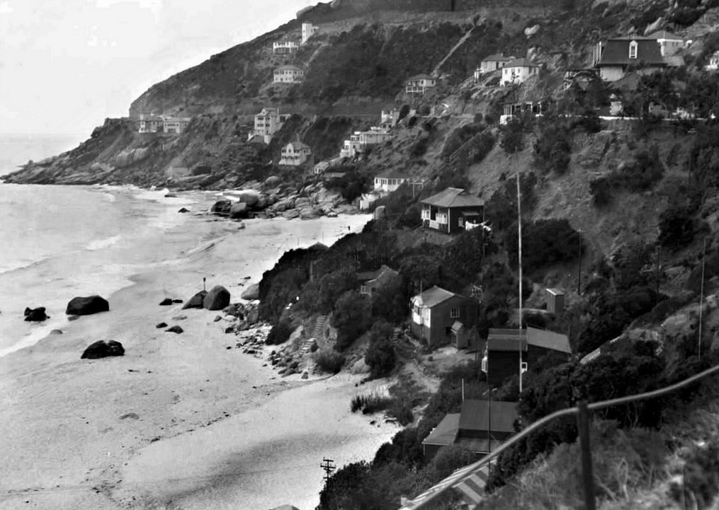
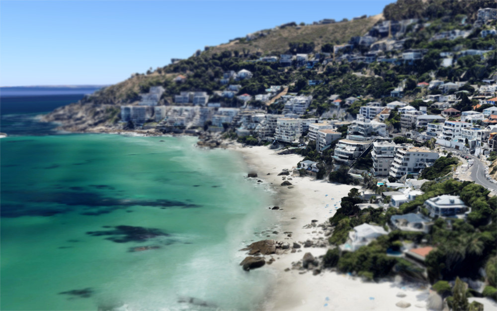
Over the years, Cape Town’s skyline has risen up, and buildings have crept closer to the foot of the iconic Table Mountain as the city spreads around the city bowl – and Clifton has changed from quaint beach-front properties to the most expensive suburb in the country.
For a look at the changes in Johannesburg, you can read more here: These pictures show what Joburg looked like in 1930
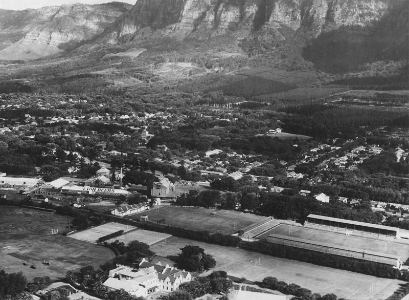
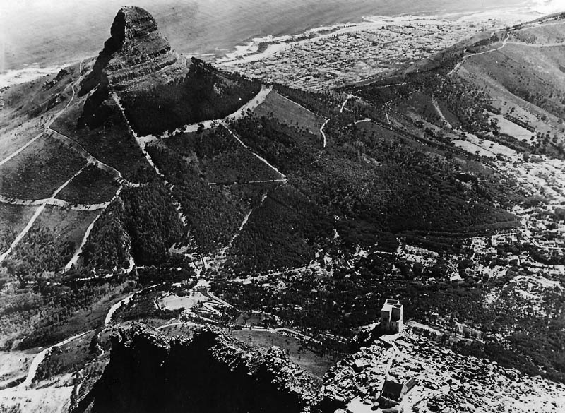
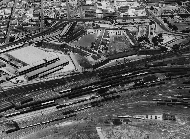
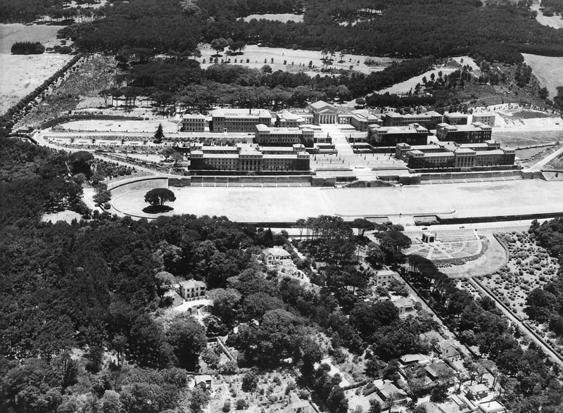
The pictures below were taken from various archives, and capture Cape Town from around 1940 and beyond. The modern re-creations taken from Google Earth.
The City Bowl


Clifton booming
Lion’s head
The old castle

University of Cape Town

Sea Point
Newlands