Here’s how many more shacks and security estate homes have been built in Gauteng over the last 17 years

The Gauteng City Region Observatory (GCRO) has released a new report focusing on residential development in Gauteng.
The report notes that an increase in people and households requires more service and transport infrastructure – leading to more social, public commercial and industrial spaces.
In particular, population and household growth drive demand for more housing and crucially the physical space to accommodate residential buildings, it said.
As part of the report, the GCRO also released a map showing the number of residential buildings that were added or removed per square kilometre in Gauteng between 2001 and 2016.
The map uses GeoTerraImage Building Based Land Use data which marks each building visible from satellite imagery and codes it with a land use.
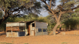
Residential buildings identified in the dataset include formal dwellings, informal dwellings (including informal, backyard and transitional structures), clusters/complexes, estates, security villages, smallholdings, rural workers housing and villages.

According to the GCRO’s data, residential buildings in Gauteng increased from just over 2 million in 2001 to just under 3.5 million in 2016 (a 60% increase).
Freehold formal housing remained the largest category of housing, followed closely by informal housing.
While freehold formal housing increased by 38% between 2001 and 2016, the growth rates for other types of buildings were much more significant over the same period, such as estate and village security housing (which increased by 249%) and backyard dwellings (increased by 204%).


However, the GCRO notes that residential growth was not spread evenly across the province, with an increase of more than 50 residential buildings per square kilometre is seen in many parts of the province.
The highest concentrations of increase (up to 9 492 units per km²) can be seen in townships such as Soshanguve, Mamelodi, Diepsloot, Tembisa, Soweto, Katlehong and Sebokeng.
This was mostly driven by the proliferation of informal and backyard dwellings, it said.
“Lower, but still significant increases in residential buildings (up to 250 buildings per km²) is very often found on the edge of the former urban footprint – constituting urban sprawl,” it said.
“A very clear arch of low density residential expansion is seen between south-eastern Pretoria and the northern suburbs of Johannesburg, much of which was driven by significant increases in estate and security village housing.
“There were also areas of the province without any residential building in either 2001 or 2016 and also areas where there was no change in the number of residential buildings,” it said.
“As one could expect, the outskirts of the province often did not have any residential buildings per square kilometre, either in 2001 or 2016, or the number of residential buildings did not see any change over the period.”
Interestingly the data shows that there is also a handful of areas within the existing urban footprint that did not see any change in the number of residential buildings, such as central suburbs of Pretoria and Johannesburg.
This is either an indication of stability or that new developments have become undesirable or unfeasible in these areas (perhaps due to the price of land or to geological constraints) or that some urban areas resist change (perhaps through restrictive land use regulations) in ways that other areas of the province cannot prevent, the GCRO said.
Although there was an overall increase in residential buildings, some parts of the province saw a decline in the number of residential buildings per square kilometre, visible in the yellow and red squares on the maps.
“In some specific cases this reduction was by as much as 1,000 dwellings per square kilometre. Reductions may have been caused by redevelopment of residential areas to commercial or other land uses, and in extreme cases it often reflects the formalisation or relocation of informal settlements.
“One such instance – emblematic of enduring spatial inequality in Gauteng – is the removal in the mid-2000s of the Zevenfontein informal settlement, making way for the Steyn City luxury lifestyle estate,” it said.
Read: Joburg is changing its rules for boomed areas – here’s what you need to know